Isaias Strengthens Into a Category 3 Major Hurricane as Landfall Nears on the Florida Panhandle

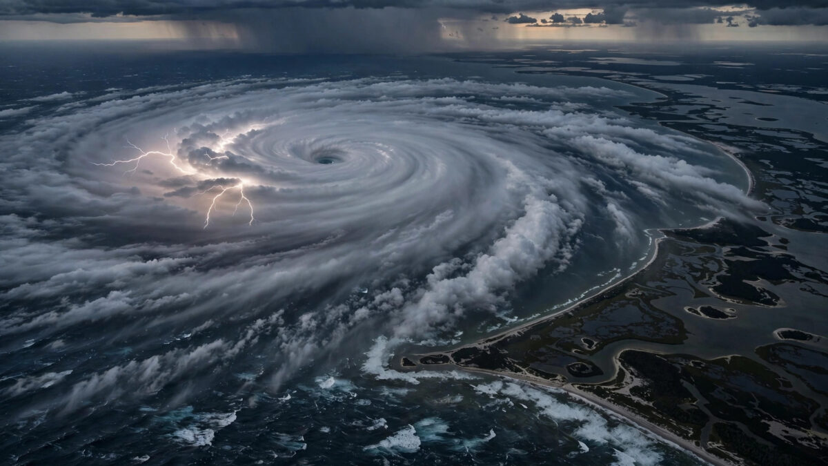
Hurricane Isaias strengthened into a major Category 3 hurricane on Friday morning, with maximum sustained winds of 120 mph, as it raced toward the Florida Panhandle for a landfall expected this evening or tonight, according to the National Hurricane Center.
The intensification, confirmed by data from an Air Force Reserve Hurricane Hunter aircraft, made Isaias the first major hurricane of the 2026 Atlantic season and the first Category 3 storm in the Atlantic basin since Hurricane Melissa last October, according to The Weather Channel. The Hurricane Center warned that Isaias was expected to remain at or near major hurricane strength at landfall, with forecasters projecting winds of about 115 mph just offshore the western Florida Panhandle by Friday evening.
The 11 a.m. ET advisory carried the center’s starkest language of the day: “Life-threatening storm surge and devastating winds [are] likely along the Florida Panhandle and Alabama coasts,” USA Today reported. As of the 10 a.m. CT update, Isaias was centered about 195 miles south of Pensacola and moving north-northeast at 16 mph — faster than earlier forecasts had expected, bringing the landfall timeline forward.
A Rapid, Ominous Strengthening
The storm’s upgrade caught even forecasters’ attention for its mechanics. According to the Palm Beach Post, wind shear around Isaias had increased as predicted, but because the shear was moving in nearly the same direction as the hurricane itself, it was having far less of a mitigating effect than expected. The storm was instead gorging on what forecasters described as the unusually and deeply warm waters of the Gulf — high-octane fuel that allowed it to deepen steadily through the morning.
The Hurricane Center’s minimum central pressure reading from a dropsonde fell to 959 millibars, a sign of a tightening, better-organized storm, according to the Pensacola News Journal. Hurricane-force winds extended outward up to 30 miles from the center, while tropical-storm-force winds ballooned to 185 miles from the center, meaning a vast stretch of the northern Gulf Coast was already feeling conditions well before the core arrived.
Isaias is also a lopsided storm, forecasters warned. Its worst impacts will lean east of the center, onto what meteorologists call the “dirty side” — a detail with serious consequences for Tallahassee and Florida’s Big Bend region, well away from the projected landfall point.
Where and When Landfall Is Expected
Federal forecasters expected Isaias to make landfall near the extreme edge of the Florida Panhandle — possibly near Pensacola — late Friday, with some forecasts pointing to a corridor between an eastern slice of Alabama and Destin, Florida, according to the Palm Beach Post. A National Hurricane Center bulletin put the center roughly 30 miles south of Pensacola Beach at 7 p.m. ET, with landfall — defined as the moment the storm’s center moves over land — expected a couple of hours later, USA Today reported.
In a Friday morning live briefing, National Hurricane Center Director Michael Brennan described the timeline plainly: “This powerful hurricane is expected to make landfall this evening into the late-night hours,” according to the Tallahassee Democrat. Even before the center arrives, tropical storm conditions were expected from New Orleans to the Tallahassee area, and inland tropical storm watches extended all the way to Birmingham, Alabama — an unusual reach that reflects how large the storm has grown.
Hurricane warnings stretched from Ocean Springs, Mississippi, to the Bay/Gulf County line in Florida, while storm surge warnings covered the coast from the Suwannee River to Yankeetown, and tropical storm warnings ran east of the Bay/Gulf County line to the Aucilla River, according to the Pensacola News Journal.
Surge, Wind, Rain and a Growing Tornado Threat
The storm surge may be the most dangerous hazard. Forecasters warned of up to 9 feet of saltwater driving into nearly 200 miles of coastline, according to the Palm Beach Post, with the worst surge expected along and just east of where the center crosses the coast. Fox Weather hurricane specialist Bryan Norcross warned that “Isaias will feature all of the hurricane hazards. Strong winds to the right of the center will spread inland. Power outages are likely,” according to the Pensacola News Journal.
The wind field is expected to punish well inland. Robbie Berg, a National Hurricane Center hurricane specialist and warning coordination meteorologist, said in the 11 a.m. forecast that “weakening will occur after landfall, but sustained hurricane force winds will likely occur near and along Isaias’s track up to 100 miles inland from the coast into southern Alabama, and gusts to hurricane force could extend even farther north into Central Alabama,” according to the Palm Beach Post.
Rainfall may prove as destructive as wind. Forecasters expected 4 to 8 inches across the Florida Panhandle, with localized amounts of up to 15 inches, the Panama City News Herald reported on Thursday, and up to 12 inches possible in the Tallahassee-to-Pensacola corridor, according to the Pensacola News Journal. The Hurricane Center rated the flash-flooding risk as moderate — level three on a four-tier scale. River flooding was also expected, some of it significant, with surge arriving at the same time as high tide in some areas, a combination that can trap urban rainwater on the surface when stormwater systems back up.
The tornado threat was drawing particular attention from meteorologists. The National Weather Service office in Tallahassee said the ingredients were in place for several tornadoes across the Panhandle and the Big Bend, and that a strong tornado — EF2 or higher — could not be ruled out, the Tallahassee Democrat reported. Meteorologist Wright Dobbs urged residents to have a way to receive warnings even after going to bed and to keep phone emergency notifications switched on. Andy Hazelton, a hurricane researcher at the University of Miami, noted that Gulf storms interacting with an upper-level trough have a history of becoming prolific tornado producers even well away from the center, citing Ivan, Beryl and Milton as examples. Forecasters put the tornado probability at 5 to 10 percent for Friday, continuing Saturday across eastern Alabama, the Panhandle, Georgia and the Carolinas.
Preparations and Evacuations
Florida Governor Ron DeSantis expanded the state’s emergency declaration to 27 North Florida counties on Thursday, according to the Pensacola News Journal. In Escambia and Santa Rosa counties, officials issued evacuation orders for zones A and B — including Pensacola Beach, Perdido Key and other low-lying areas — plus anyone in mobile homes or flood-prone areas regardless of zone, the News Journal reported in its live coverage. States of emergency were also in effect in parts of Alabama and Georgia as the hurricane warning held along the coast.
Residents across the region were told to rush preparations to completion in the morning, with the National Weather Service in Mobile warning that “impacts peak Friday afternoon through early Saturday morning.” Swells from Isaias were already producing life-threatening surf and rip currents along the western and northern Yucatan and spreading toward the Gulf Coast.
After landfall, forecasters expect Isaias to weaken and likely become post-tropical by late Saturday, but its heavy rain and gusty winds will spread well inland across the Southeast — through Tennessee, Georgia and the Carolinas — and eventually reach parts of the Great Lakes and the Northeast, including Washington, Baltimore, Philadelphia and New York City, by Sunday, according to The Weather Channel.
The storm carries a piece of history with it. Isaias is the first hurricane of the 2026 Atlantic season and is forecast to be the first hurricane to strike the United States since Hurricane Milton — which hit Florida exactly two years ago, on Oct. 9, 2024 — according to USA Today.
Analysis: Why It Matters
Isaias is a case study in how quickly a “manageable” storm can become a dangerous one. Just days ago it was a tropical depression; by Thursday it was a Category 2 approaching the coast; by Friday morning it was a major hurricane. The shear-alignment quirk that forecasters flagged — wind shear running parallel to the storm’s motion rather than tearing it apart — is a reminder that intensity forecasting remains the weakest link in hurricane science, and that a population preparing for a Category 2 must be able to absorb a Category 3 reality on a few hours’ notice. Evacuation orders in Escambia and Santa Rosa counties were issued Thursday, before the upgrade; the question emergency managers now face is how many people made their stay-or-go decision based on the weaker storm.
The geography of the threat matters too. A landfall near Pensacola puts the storm’s dirty side — its eastern flank — squarely over the most populated part of the Panhandle and into the Big Bend, including Tallahassee. In lopsided hurricanes, the headline landfall point is almost a decoy; the surge, tornadoes and rainfall extend far beyond it. The Tallahassee warnings about nocturnal tornadoes are particularly worth heeding: tropical tornadoes after dark, striking people asleep in mobile homes and low-lying houses, are among the deadliest secondary hazards a hurricane produces.
There is also the longer signal. Isaias is the first hurricane of a 2026 season that waited until October to produce one — and then turned it into a major hurricane racing toward land on an extremely warm Gulf. The “high-octane fuel” description forecasters used is not color; Gulf sea-surface temperatures far above normal are what allowed a storm in October to find the energy it did. As the storm’s remnants track toward the Northeast over the weekend, the disruption will not end at the coast — from flash flooding in Georgia and the Carolinas to airline and freight delays across the Southeast, the economic footprint will keep widening after the winds drop.
What to watch next: the precise landfall point and whether the eyewall crosses near Pensacola at major strength; overnight tornado warnings in the Panhandle and Big Bend; the speed of the post-landfall weakening, which determines how far hurricane-force gusts penetrate into southern and central Alabama; and the flash-flood situation around high tide on the Panhandle, where backed-up drainage could turn heavy rain into street-level inundation.
Sources
- USA Today: Hurricane Isaias landfall expected tonight — live forecast updates
- Pensacola News Journal: Live updates — Isaias to make landfall at or near major hurricane strength
- Tallahassee Democrat: Isaias may be a ‘prolific tornado producer’ for Tallahassee, Big Bend
- Palm Beach Post: Isaias could maintain Cat 3 strength into Florida, Alabama landfall

About the Author — Abdul Mannan
Related Articles
Judge Reopens Christa Pike’s Challenge to Tennessee’s Lethal Injection Protocol After Botched Execution
A Nashville chancery judge has reopened Christa Pike's dismissed challenge to Tennessee's lethal-injection protocol, ruling she demonstrated "extreme,…

ICE Agent Shoots Man in Bronx With 5-Year-Old in Car; Mamdani Demands Halt After Two-Hour Call With Trump
A federal immigration agent fired seven rounds at a car in the Bronx on Thursday, wounding a 28-year-old…

Trump Rules Out New Iran Strikes Before Midterms as Oil Prices and Tanker Attacks Escalate
President Trump declared on Truth Social that the United States "will not be attacking Iran at any time…